These Drones Can Search and Rescue Without GPS
Melanie Gonick/MIT


Traditional technologies don't always work in remote areas of the wilderness.
Drones are often a quality search and rescue tool. The Interior Department recently made excellent use of them in Hawaii to find and help people trapped by lava.
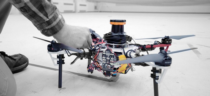
But drones aren't perfect at the task. Often, dense forests can block GPS signals that locate people. Researchers at the Massachusetts Institute of Technology believe they have a solution. Instead of GPS, these new drones use LIDAR, a combination of laser and radar. This is the same technology that guides the self-driving cars on our roads.
The LIDAR system creates a 2D scan of the area that also includes the orientation of multiple trees, allowing the drones to determine where they have been and where they need to go next.
The drones will still need to communicate with a ground station to create a fully 3D map.
"Essentially, we’re replacing humans with a fleet of drones to make the search part of the search-and-rescue process more efficient,” said Yulun Tian, a graduate student in the Department of Aeronautics and Astronautics to MIT News.
MIT shows the drones in action in the video below: