The Future of Drones? Apps
Flickr user Eugene Kim


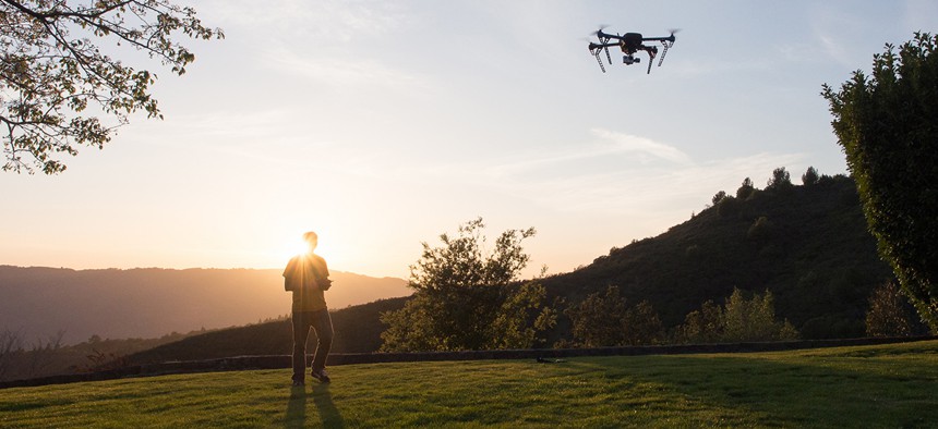
Hivemapper, a Web and Android app hints at what might be ahead for drones.
Phones used to just call people. Then we put cameras and the internet in them, and a man in a mock turtleneck created one that revolutionized the way we communicate. You might be surprised to hear it, but we’re near a similar inflection point with drones.
Right now, they’re seen either as scary, privacy-invading hovering robots, or cameras with wings of uncertain legality that hobbyists use to take photos. But in the near future, they could become as important to the way we live and work as smartphones have become. What’s missing right now is a developer community making apps that transform drones into new tools that their manufacturers haven’t even imagined. And that might be right round the corner.
Hivemapper, a web and Android app that launched today (Nov. 5), hints at what might be ahead for drones. It’s a mapping program that turns a smartphone into an augmented-reality viewfinder when it’s paired with a DJI drone. It also gives information on where drone owners can fly, and what to look out for. CEO Ariel Seidman told Quartz that he wants to be the Waze for drones.
Using a machine learning system, Seidman said Hivemapper was able to analyze high-resolution satellite images to figure out the exact shapes of 20 million buildings in the US, and the heights of 10 million of those, and show users that information in real time as they fly.
The app also has information on 16,000 airports and no-fly zones in the US, and thousands of points of interest, some of which were contributed by drone enthusiasts (mainly in the Bay Area) during a closed beta trial. When flying a DJI drone with the app, users get a Google-Earth-like experience, where they can tap on buildings and points of interest they fly by to learn more about them.

The app also shows users when they’re getting too close to a building and alerts them to change course. In the future, Seidman said he’d like to be able to digitally fence off every building they’ve mapped, so that the app won’t let a drone fly closer than a certain distance around buildings so that they don’t crash into them.

Like with Waze, Hivemapper users will be able to add new information to the map, like any places they should avoid flying at a certain time—perhaps if there’s a forest fire in the area. Seidman said the company intends to share the information it collects from users with the Federal Aviation Administration (FAA).
He added that Hivemapper expects to add more data over the next six months, as the number of consumer drones in the US is set to explode. The FAA said that it expects up to 1 million drones to be bought as presents this holiday season.

Last November, DJI released a developer’s kit so that anyone could make apps for its drones. Earlier this month, it released a computer designed especially for drone tinkerers and developers. There hasn’t yet been an abundance of apps produced for DJI’s drones, but as more developers get their hands on computers and drones that they can play around with, that’s likely to change.
Seidman said his team worked with DJI so their app would work with all its drones. Theoretically, any Android or iOS developer could build an app that would work with a drone—they code in the languages they know, and DJI’s software developer kit handles talking to the drone. Seidman said we’re likely to see far more applications specifically released for drones soon. In his eyes, it’s similar to how it took about a year for apps to explode on the iPhone after the developer community had time to play around with ideas. Drones are, after all, essentially cameraphones with wings.
In the next year, the FAA should have its regulations on commercial and consumer drone use in place, which could inspire all sorts of new uses for drones.
Hivemapper, or an app like it, would be an ideal backbone for companies like Amazon, Walmart, and Google that are experimenting with drone delivery services. Drones could know where they are in relation to things they might crash into. Customers could then use an Uber-like app to figure out where their packages are. Drones could be used to help farmers track their crops from overhead—which companies like Flyver are currently providing bespoke solutions to do.
Seamless and other food delivery apps could replace drivers with drones to get meals to lazy urbanites more easily. CNN could connect its burgeoning drone journalism project with the all the civilians that contribute footage through iReport. Periscope would be a lot easier to control from a drone you toss up into the sky during an event than a shaky iPhone camera. Martha Stewart even thinks drones would be great for helping out with home improvements.
Drones can also carry just about any sensor, and go places that most internet-of-things devices coming onto the market can’t. Shell is already exploring using drones to monitor its power plants. Drones could explore the sky—perhaps predicting the weather before it gets to us, or maybe even negate the need for Waze, replacing traffic cameras around the world.
All it would take are mobile developers to come up with the right ideas—as they did back in 2008 with the iPhone, and as they’re doing right now with the Apple TV, the Apple Watch, and every other IoT device.
DJI already has a few apps it’s showcasing on its website, including a drone-mounted parking inspector it partnered with Intel and China’s Fudan University to create, that can figure out if someone’s parked illegally from the sky. No more double-parking and checking to see if the parking attendant is coming—they’ll be hiding in the clouds now.
That’s just one application in the works—there are others. BrightSky Labs—another company DJI’s highlighted on its site—is trying to become the Instagram for drones: Users take a video or phone with their drone and upload it to the web right from their mobile device. US drone manufacturer 3D Robotics also recently launched a developer program.
In two years, between the FAA’s rulings, his company’s app, more autonomous drones, and other developers joining the fray, Seidman thinks it’ll be safe to fly drones in US cities. Perhaps by then, personal drones and drone deliveries will be as commonplace as smartphones are today. Whether that ends up happening—or whether the US public will see the utility in having drones buzzing around them at all time—remains up in the air.