The Unsettling Rise of the Urban Narc App
nattawit.sree/Shutterstock.com


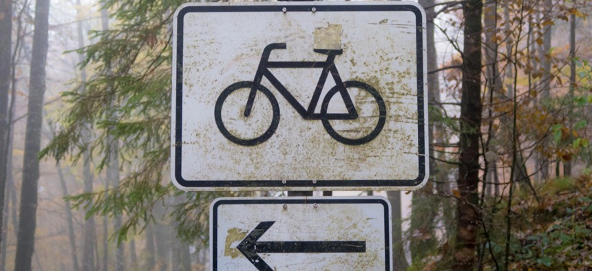
It’s getting easier for city residents to use technology that can report bad drivers who block bike lanes. Welcome to the self-surveillance era of traffic safety.
Say you spot a truck blocking a bike lane in San Francisco’s Mission District. Using a new app called Safe Lanes, you can snap a picture of the offending vehicle’s license plate, and beam it up to a constantly refreshing, GPS-coded map. Meanwhile, Safe Lanes will take your image and run it through a license plate reader. Then, it will use the ID to automatically fill out a complaint form and submit it directly to the city’s non-emergency 311 service. If you’re lucky, officials will respond swiftly, and the vehicle will be towed, or the driver will be given a citation. You’ll also get a list of all the previous traffic tickets and citations the offending vehicle has earned. The bike lane will be clear, someone will (hopefully) learn their lesson, and you’ll get some satisfying closure that leaves a positive—potentially life-saving—mark on society.
On Valencia Street, Safe Lanes users have documented Priuses and delivery trucks and pickups and Ubers blocking the bike lanes every few feet. Seeing those violations (represented by red or yellow exclamation points) on an ever-updating map offers a powerful visual reminder of the safety crisis on city streets: Bike lanes are being ignored, bicyclists and pedestrians are being killed by drivers, and cities are failing to live up to the Vision Zero pledges they’ve made.With an app like this, citizens are equipped with tools that can hold drivers accountable for risky behavior—and cities get the data they need to build better bike infrastructure.
But the pictures of people’s license plates, and their location on a geo-tagged map, don’t just disappear once justice has been served: They live on for anyone on the internet to see. And as other kinds of citizen-powered crime-tracking form an ever-widening panopticon over our urban space, the act of recording and displaying that data has become more fraught.
Amazon’s Ring doorbells—video surveillance devices homeowners affix to their front doors—are now being used by more than 400 police departments around the country to catch criminals. Citizen, a crime-tracking app that scrapes 911 and police dispatch data and allows onlookers to livestream and comment on in-progress emergencies, offers users a real-time glimpse of urban disorder—which may have psychological effects that change the way residents think about their cities. On the social-media platform Nextdoor, neighbors can post updates on purse-snatchings and “shady characters” alongside furniture giveaways and lost dog notices, leading some to see the site as a kind of petri dish for racial profiling. And a Buzzfeed News investigation found that even regular city-run 311 nuisance-complaint portals have been increasingly used to report noise violators in gentrifying neighborhoods.
Amidst this burgeoning landscape of technology designed to maximize opportunities for urban narcing, a bike-lane-defender app stands out as a beneficial means of evening the balance of power between cyclists and drivers. But does it also get us one more step down the slippery slope to a self-surveillance society?
“There’s been this cultural shift of normalizing that it’s OK to be taking photos and videos of other people in public,” said Rachel Thomas, the founding director of the Center for Applied Data Ethics at the University of San Francisco’s Data Institute, and the co-founder of the online coding school fast.ai. The illusion of privacy in the public sphere may have always been an illusion, but with many more eyes and lenses trained on the streets, the age-old practice of “being seen” can evolve quickly into being shared, and being stored. And perhaps being unfairly tried and convicted in the court of public opinion.
This new armory of citizen-reporting technologies come in varying stripes and levels of stakes, and in many ways they reflect a wider and older trend: the use of social media as a tool for tattling on peers. (See: This gotcha image of Ivanka Trump’s motorcade blocking the bike lane in D.C.’s Columbia Heights.)
But there’s a growing desire to create a centralized site for such records of bad behavior—one that anyone can access, and that can function as a deterrent for other prospective offenders. It’s driven in part by the understanding that local governments aren’t fully up to the task of policing, and don’t always act swiftly, efficiently, or in the public’s best interest. And it’s compounded by the techno-chauvinist conviction that collecting data from anyone and everyone is the first and most critical step to solving the world’s problems. Often, bureaucracies won’t even think about overhauling systems—like bike infrastructure—unless given compelling evidence. Many cities just don’t have the resources to collect that evidence themselves.
Stephen Braitsch, a San Francisco-based designer and engineer, dreamed up Safe Lanes after the death of Tess Rothstein, who was killed while riding her bike down San Francisco’s downtown Howard Street this March. Had there been protected bike lanes on the street, Braitsch says, maybe Rothstein wouldn’t have had to swerve into traffic to avoid the swinging door of a parked car, and maybe a truck wouldn’t have hit her.
Existing mechanisms for reporting driver infractions had severe limitations, he said: San Francisco’s 311 app can’t record the exact location at which a car was found, using the photo’s metadata. (Safe Lanes can.) It can’t instantly tell you how many other traffic citations and reports that one vehicle has accrued. (Safe Lanes can.) And even when 311 does receive accurate reports, it isn’t clear what the office does with them, or when. “Right now, essentially the 311 app is a [door-close] button on an elevator,” Braitsch said. “You get the sense that you’re doing something, but it’s actually not doing anything.”
Having a publicly viewable map allows citizens to identify dangerous patterns that might otherwise not be visible. The majority of the blocked bike lanes Safe Lanes users have recorded, for example, occurred in a two-block area around where Rothstein was killed, Braitsch says. That knowledge can in turn fuel targeted political activism. One UPS truck identified on the platform has 10 reports out against it and 27 citations, for example. Safe Lanes can bring that information to UPS’s attention, ask them to strengthen driver trainings, and get bad drivers off the roads. When aggregated with other data, Braitsch says he’s bringing violation hot spots to the attention of city authorities, so that they can take action, too.
“It can also be a powerful deterrent if motorists know that there is a central database that is tracking these violations and that they are being watched,” said Braitsch. “Similar to how red light cameras are proven to deter motorists from running red lights.”
The safety benefits of red-light cameras technology, which automatically capture images of cars that run stop lights or signs and then issue tickets, appear to be clear—studies conducted by the Insurance Institute for Highway Safety show that these cameras reduced the rate of infractions and crashes. But the privacy trade-offs associated with red light cameras have also drawn criticism. The ACLU has called on cities to delay the process of deploying them amid concerns that they could violate the “innocent until proven guilty” principle. Civil liberties advocates argue that the information they collect could “be used for purposes other than tracking reckless drivers.” In June, Texas joined seven other states in banning red light cameras entirely, according to the New York Times, after driver-advocacy groups pushed back using a similar argument that their use impedes due process.
“Knowing what we know about surveillance, surveillance tools end up being pointed towards the less powerful, in general,” says Thomas, no matter the original intent. In some ways, these emergent forms of reporting technologies have the potential to rebalance that power: Homeowners can fight back against thieves that come to prey on their stuff while they’re at work in the middle of the day; pedestrians and cyclists can exact some vengeance on the hulking vehicles that block and menace them.
But once that information is collected, the layers of power get much more tangled. In San Francisco, license plate information collected by law enforcement and private operations was stored in a database that Immigration and Customs Enforcement gained access to; privacy and immigration advocates warned that ICE could easily use it to target undocumented immigrants. What if that car blocking the bike lane belongs to someone whose immigration status is uncertain, and their license plate information—and location—is used to speed their deportation? What if the Ring camera footage that a homeowner shares with police helps them identify the wrong suspect—or Amazon uses it as an ad for thousands of viewers to see? Cellphone footage that can expose the killings of unarmed black men at the hands of police can just as easily be used to shame a D.C. metro employee for eating lunch on the job, Thomas says.
“I used to ride my bike to work, and I don’t anymore because I find it so dangerous, so I’m sympathetic to that frustration,” she said. “But I really—I am uncomfortable with further normalizing surveillance and putting information out there another way.”
Braitsch says that he’ll never provide personal information on drivers in the app, and points out that government portals already let people request the license plate numbers of people involved in collisions or cited for running red lights. He’s just making the process more streamlined and accessible. With so many tools out there that aid in surveilling, maybe citizens themselves just need to better understand how to use those tools, and how not to.
Mark Sussman, a D.C.-based systems analyst at the data think tank Mathematica, has co-developed a different sort of traffic-safety reporting app, which launched in beta mode seven months ago. Called “How’s My Driving”—and soon to be renamed “Our Streets,” to reflect the future it’s working towards—Sussman’s web app allows people to identify vehicles that are standing, moving, or parked in dangerous ways on the D.C. streets, and report them directly to parking enforcement, 311, or the Department of For-Hire vehicles, if they’re an Uber or a taxi. How’s My Driving also lets people see how many outstanding traffic citations each vehicle has received; the record, Sussman says, is about $37,000. To date, there’s been $3 million in unpaid fines associated with 12,000 submissions.
But while it takes note of each vehicles’ location and license plate number, How’s My Driving does not plot pictures of those license plates on a map. For now, those who want to report violations directly to 311 have to tweet at the department—but in an updated version, there will be more integration and no need for that public-facing report. That’s intentional, Sussman says: both to protect the reporter from social media backlash, and the driver’s privacy.
“[When] we started it … people were on Twitter using this kind of as a quote-unquote ‘shaming’ tool—but I don’t view it that way,” said Sussman. “It was more like a cathartic exercise for folks, because you can only shame people if they know they’re being shamed.” Now, there’s a greater emphasis on instant feedback. If an investigation is launched into a for-hire vehicle, the user who reported the violation will get an in-app notification, for example. This month, How’s My Driving led a day-long Bus Lane Blitz, which brought together a group of volunteers to monitor D.C.’s dedicated bus lanes on H street to see how many vehicles blocked them. They recorded nearly 300 violations, and earned lots of local media coverage.
“Visualizing it is not enough,” Sussman says. “If you just yell from the outside it doesn’t do anything.” He and his co-founder have turned what started as a pet project into a full-fledged business, with grant money, placement in a start-up accelerator program, and a B2B partnership with a local ride-sharing company that wants help keeping their vehicles law-abiding. He’s having conversations with Austin, Arlington, and Pittsburgh, in the hopes of bolstering their traffic enforcement efforts, too.
“If you ask any parking enforcement agency, they’re going to say we don’t have enough resources to [issue the fines], and this is a way to maximize the resources that they do have,” he said. “All of a sudden if you have a lot more eyes on the streets that are tagging vehicles that are doing dangerous things. You have a lot more reach across the city.”
What Sussman and Braitsch both highlight is the helplessness they and their fellow cyclists felt before having a venue to post what they saw, and the gratification they’re getting now. After Dave Salovesh, a beloved D.C. bike advocate, was killed by the driver of a stolen van while cycling in April, Sussman says people told him they turned to the app because it was “something to do.”
“There is a service gap between 311 requests and 911 requests, specific to street safety,” Sussman added. “If a vehicle is blocking a bike lane or parked in a crosswalk or on a sidewalk, that is an urgent request.” How’s My Driving and similar reporting tools can elevate that urgency, and make sure that officials listen to pedestrians’ pleas.
So far, just griping on social media hasn’t been powerful enough to do that, says Braitsch; apps like Safe Lanes can help cyclists build “enough of a militia or a groundswell to put pressure on elected officials to make a response, as opposed to people just throwing one dart at a time, randomly.”
In other words, it’s government inaction, not the technology itself, that’s conscripted this militia into surveilling their fellow citizens through their doorbells and their smartphones. And it can be government action that quells the need for them.