Today's weather forecast, brought to you by China?


 By
Frank Konkel
By
Frank Konkel
NOAA's best option for bridging its gap in polar orbiting satellite coverage may be to rely on Chinese data -- a solution that could create problems of its own.
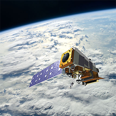
NASA joint polar orbiting satellite. (NASA image)
Using data from Chinese satellites might be the closest thing the National Oceanic and Atmospheric Administration has to a "silver bullet" fix for a potential gap in polar-orbiting weather satellite coverage that could dangerously impair U.S. forecasts, a NOAA-commissioned study says.
But involving China in a U.S. satellite program could run into both practical and political difficulties, and a key appropriator said he has "very serious concerns" about any such plan.
The NOAA study examined 44 potential solutions to an expected gap that could occur as early as 2014 in weather satellite coverage between NOAA's existing polar-orbiting satellites and its next-generation $13 billion Joint Polar Satellite System (JPSS), which is not scheduled to launch its first satellite -- JPSS-1 -- until 2017.
The gap could have a significant effect on weather forecasts produced by U.S. and European weather models, and has national security implications because the Defense Department, which has its own aging polar-orbiting satellite program, currently relies partially on data from NOAA's polar-orbiting satellites to position its spy satellites.
FCW obtained a copy of the study, titled "JPSS Gap Mitigation Analysis of Alternatives," which was completed by Colorado-based Riverside Technology and Virginia-based Integrity Applications in February but not released publicly.
The firms produced a number of recommendations for NOAA to consider as the agency charts a mitigation plan for its satellite program, which will be one of the talking points as officials from NOAA and the Government Accountability Office testify before the House Science, Space and Technology Committee on Sept. 19.
NOAA declined to comment on the specifics of the report. An agency official told FCW that "based on security concerns, NOAA believes that this would be a 'whole of government' decision, possibly involving the Department of State, the Department of Defense and the U.S. Congress. It would not be solely a NOAA decision." The Riverside study itself, however, clearly suggests that using Chinese satellite data could be the best option.
"The Riverside team views this idea as potentially the sole silver bullet among the ideas, one that would require a partnership with the Chinese to allow the use of the Feng Yun 3 data," the study said. "The idea is most attractive because the satellites provide nominally the same information and will reside in approximately the same orbit as will JPSS-1, and new satellites will be launched well before the projected gap in NOAA polar satellite coverage."
Polar-orbiting satellites orbit 500 miles above the Earth's surface and provide measurements such as a storm's direction, speed and intensity. U.S. and European weather models rely on data from three such satellite programs to produce medium-range weather forecasts. Data is shared through the World Meteorological Organization.
Data from the afternoon orbit of NOAA's polar-orbiting satellites is pooled with data collected during the mid-morning orbit of the European Organization for the Exploitation of Meteorological Satellites' (EUMETSTAT's) Metop satellite and the morning orbit of a satellite operated by the Air Force's Defense Meteorological Satellite Program.
This kind of data proved vital during the early forecast of Hurricane Sandy, which provided ample warning for East Coast residents to evacuate before the storm veered toward land.
According to the Riverside study, the China Meteorological Administration operates two Feng Yun-3 series satellites -- FY-3A and FY-3B -- with sensors comparable to NOAA's existing polar-orbiting satellites. In 2013 and 2014, the Chinese satellites FY-3C and FY-3D will become operational with sensors comparable in quality to NOAA's next-generation JPSS.
The study indicates the European Centre for Medium-Range Weather Forecasts (ECMWF), which provides forecast data to the European National Weather Service, already receives and monitors data from the Chinese FY-3A and -3B satellites, having developed algorithms that can assimilate the data into research models. The Chinese data is not as good as that from the afternoon orbit of NOAA's polar-orbiting satellites, but if NOAA's satellites fail, the ECMWF indicated it would use data from the Chinese.
"(The ECMWF) are not assimilating the FY-3 data in their operational models now, but have stated they would use the data during an afternoon orbit data gap," the study said. "While Chinese polar satellite data have been available, the U.S. has not used the data for various reasons. However, these data have the potential to virtually mitigate in full any degradation of NWS weather services caused by a gap in U.S. polar-orbiting satellites."
Fiscally feasible, but politically charged?
U.S. officials have not been high on sourcing contracts to companies tied to China, especially in the IT arena, so relying on Chinese satellites for vital information might be a tough sell.
Rep. Frank Wolf (R-Va.), chairman of the House Appropriations Committee's Commerce-Justice-Science Subcommittee, recently included language in a funding bill that would restrict NASA, the National Science Foundation and the departments of Justice and Commerce from acquiring IT systems that include any components from companies "owned, directed or subsidized" by China. NOAA is housed within the Department of Commerce.
Wolf told FCW in a statement that he had concerns over any NOAA-led option to mitigate the weather satellite gap using Chinese satellites.
"It is my understanding that NOAA has proposed several options to fill potential gaps in weather satellite data," Wolf said. "I would have very serious concerns about any option involving China, especially given the unprecedented cyberattacks against U.S. networks by the Chinese government. The committee will work closely with NOAA to encourage alternative options that would not expose our systems to potential threats."
If NOAA proposes a partnership with China to use data from its polar-orbiting satellites, it is sure to raise eyebrows in Congress and the public, said Dean Cheng, senior research fellow at the Heritage Foundation.
An expert on Chinese political and security affairs, Cheng said China's space program is state-run with a heavy military component, and noted China places high importance on its growing weather satellite program.
The United States spent billions of dollars on the National Polar-orbiting Operational Environmental Satellite System (NPOESS) from 2002 through 2010, when the joint DOD-NASA-NOAA program was disbanded after a series of cost overruns, schedule delays and management problems. NOAA established the JPSS program shortly after, but it too has been subject to a series of critiques from independent oversight bodies, including GAO.
Cheng said any decision on whether or how the United States should utilize information coming from Chinese polar-orbiting satellites deserves serious scrutiny.
"Are we prepared to depend on a country that, at the end of the day, has fundamentally different views on issues than we do, is at odds with our allies and with whom we have mixed feelings?" Cheng said. "China is not an enemy state, but in the middle of a crisis in which we're at odds, how confident can you be on that data?"
Should future Chinese polar-orbiting satellites share information with the World Meteorological Organization, there may not be a cost associated with the NWS incorporating data from the foreign satellites into weather forecasts. The United States already shares weather information with Europe through the WMO. The price tag could be big plus for budget hawks in tight fiscal times.
But it also could leave the United States dependent and vulnerable, according to Eric Webster, vice president and director of weather systems at ITT Exelis Geospatial Systems, especially if the federal government does little to bolster U.S. satellite programs.
In times of conflict or disagreement with the United States, China could cut its satellite data feed or even spoof its satellite data, Webster said, noting that China has launched its own spy satellites that rely on the same weather data.
He said that, depending on how the United States made use of the Chinese polar-orbiting satellite data -- in forecasting or for intelligence purposes, to properly position its spy satellites -- lives could be at stake.
"It is kind of a house of cards built on sand, they [Americans and Europeans] are all relying on each other in a sense to ensure data is robust and timely," said Webster, whose company builds sensor instruments for satellites. "Fewer satellites mean data is older or doesn't refresh as quickly. If there comes a time when the Air Force needs cloud forecasts, China would know exactly when and why and where the data is and what the U.S. military wants to use it for."
Cheng said whatever the United States decides to do needs to involve its own satellite programs.
"The worst outcome out of all this is if we take no steps at all to put American satellites up," Cheng said. "That would leave us with a long-term issue of being vulnerable on weather information and end up depending on outside sources."
Other weather-gap mitigation options?
The Riverside study identifies 12 "high-merit" ideas for NOAA to consider.
These options involve "expanding the use of currently available data, obtaining data from future sources, enhancing data assimilation for numerical weather prediction, leveraging non-U.S. numerical weather prediction results, accelerating global model research, and providing continuity of direct satellite downlinks for weather operations in Alaska."
However, a NOAA official not authorized to speak publicly about the issue told FCW that while mitigating the gap is possible, no combination of actions could fully replace the loss of the agency's polar orbiting satellites.
On the defense side, a recent study by the Aerospace Industries Association (AIA) recommends against DOD relying on foreign non-ally weather information as it looks to mediate its own aging Defense Meteorological Satellite Program (DMSP). DOD has access to information from six polar-orbiting satellites, including two of its own and four from NOAA and EUMESTAT -- each has an operational and backup satellite.
But by 2019, the Pentagon will rely on one aging DMSP satellite, one NOAA satellite and one European asset if DOD takes no action, the report states. DOD has at least one unlaunched DMSP satellite, but it was built in the 1990s s and would have been in storage for approximately two decades by the time it could launch.
The AIA study recommends a combination of DOD owned-and-operated replacement systems, a partnership with Canada on its planned Polar Communications-Weather Satellite mission, and agreements with commercial enterprises to deal with its upcoming gap.