NOAA to Improve Storm Surge Predictions Ahead of 2023 Hurricane Season
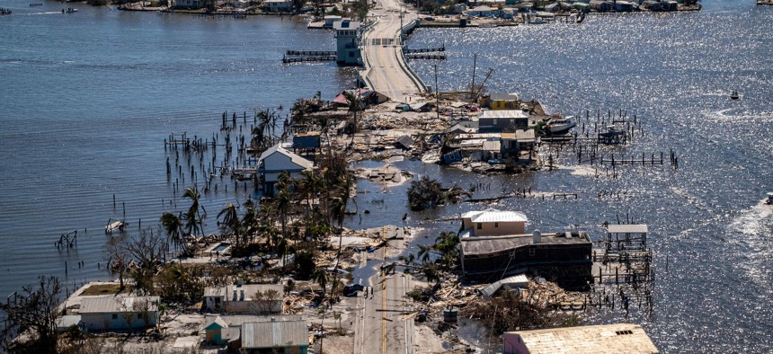
An aerial picture taken on September 30, 2022 shows the only access to the Matlacha neighborhood destroyed in the aftermath of Hurricane Ian in Fort Myers, Florida. NOAA recently announced an update to its model used for predicting storm surge from hurricanes and tropical storms. RICARDO ARDUENGO/AFP via Getty Images


The agency upgraded its system to improve modeling and forecasting for storm surges and related flooding.
Ahead of hurricane season 2023, which will begin on June 1, the National Oceanic and Atmospheric Administration upgraded its Probabilistic Storm Surge model to advance storm surge modeling and forecasting, according to an announcement on Tuesday.
The P-Surge model is the main method used to predict storm surge—or water rising above normal tide levels because of a storm, which can cause flooding—from weather like hurricanes and tropical storms. It was upgraded to version 3.0, which will help modeling and forecasting for the contiguous U.S., Puerto Rico and the U.S. Virgin Islands.
The upgrade includes several new capabilities to improve the understanding of storm surge risks, such as:
- New forecasts for surge, tide and waves in Puerto Rico and the U.S. Virgin Islands.
- The capability to run the model for two storms at the same time, which could help when two storms are hitting the contiguous U.S. or when there is a storm affecting the contiguous U.S. and another affecting Puerto Rico and/or the U.S. Virgin Islands.
- Better model calculations of friction over different land surface types to more accurately compute flooding along the coast.
“We are seeing a sharp increase in catastrophic storm surge impacts in our coastal communities,” Ken Graham, director of NOAA’s National Weather Service, said. “Our new capabilities to effectively and accurately model and forecast storm surge is critical to upholding the NWS mission of protection of life and property.”
According to NOAA, the extreme flooding caused by storm surge can destroy coastal communities.
NOAA noted that the first version of the P-Surge model—released in 2008—was “galvanized by the significant impacts of storm surge on communities along the Outer Banks of North Carolina and southeast Virginia following Hurricane Isabel in 2003.”
The P-Surge model runs in advance of hurricanes and tropical storms that could impact the Atlantic and Gulf coasts and now includes Puerto Rico and the U.S. Virgin Islands.
The P-Surge model leverages official wind forecasts from NOAA’s National Hurricane Center and the center’s historic five-year average errors in track, size and intensity of storms to create a collection of 500-1,000 representative wind and pressure inputs, which are then put into NOAA’s Sea, Lake and Overland Surges from Hurricanes model—which combines water levels and overflow from storm surges and tide. Then, the P-Surge model combines the water levels from SLOSH and the likelihood of the inputs from NHC data to create its probability products. As a result, this generates a range of potential outcomes based on the percent chance of each and enables forecasters to communicate predictions and worst-case scenarios.
NEXT STORY: A Lot of Managers Don't Like Working With Gen Z