Video: Spy Agency’s Open Source Mapping Tool Helps First Responders Save Lives
NGA


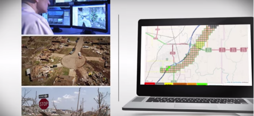
GeoQ has helped in crises around the world.
Disasters can strike swiftly and suddenly, like a tornado in the heart of Oklahoma. The first 24 hours after a natural disaster are critical, and both first responders and analysts don't have a lot of time to parse through multiple information channels to get accurate, updated information.
Enter GeoQ, a Web-based, open source workflow and mapping platform.
GeoQ organizes geospatial data from multiple sources, which prevents redundancy and determines where help is most needed.
Project leader Raymond Bauer, with the National Geospatial-Intelligence Agency, recently won Nextgov's 2015 People's Choice Bold Award for his efforts in spearheading GeoQ.
It's the first NGA project to leverage open source code-sharing site GitHub.
Since its inception, GeoQ has been used 15 times around the world, including the devastating earthquake in Nepal and the typhoon in the Philippines.
To learn more about GeoQ and to see the interface in action, check out the video below:
NEXT STORY: What Facebook’s ‘Lean In’ Guru Can Teach Troops