How to See Invisible Infrastructure


I spent a weekend at the International Utility Locate Rodeo, where people compete to find hidden cables, water mains, and gas lines.
“So what brings you to Atlanta?” the man at the Alamo rental-car desk asked my friend Sam. We responded perhaps more eagerly than necessary.
“You know those markings you’ll see on the sidewalk that tell you where a gas main is or the signs that tell people to call before they dig?” Sam began.
“We’re here for an event where the people who make those markings do that competitively, for money,” I added. “We’re here to watch."
The clerk looked at us as though we’d just told him we were in town to check out some exceptionally slow-drying paint. He very cautiously encouraged us to have fun.
It’s a struggle to explain the 14th Annual International Utility Locate Rodeo to anyone outside of the utility-locator world. To begin with, most people don’t realize there is a utility-locator world—who utility locators are, what they do, and how they do it. They definitely don’t understand why it’s a skill to be celebrated, or why I, along with my friend and fellow infrastructure-enthusiast Sam Kronick, would spend a weekend watching that celebration.
I came to the rodeo after spending the better part of the past year chasing clouds—or, more accurately, chasing the pernicious metaphor of The Cloud, trying to get a grasp of the geographic expanse of data centers, microwave towers, and millions of miles of cable that make up the Internet, but that, for the most part, are hard to see and easy to ignore. For me, the cable markings and flags left by locators had been a kind of hack. While almost no companies will just tell you where their data centers are, telecommunications firms are legally obligated to make their cables easy for excavators to find.
I’d been documenting those markings for months, but I’d never actually seen anyone making them in the field. Following strands of high-capacity fiber optic cable led me to Atlanta, to the rodeo, in search of another thread that might connect the people marking that cable with the ones who built multi-billion dollar industries on top of them.
* * *
Well, I didn’t follow it to Atlanta exactly. The actual competition was held on the University of West Georgia campus, while the expo prior to the rodeo was at the Atlanta Airport Marriott, a strange placeless fiefdom just outside the sprawling citadel that is Hartsfield-Jackson International Airport. It was in this theater that my crash course in the locating industry began.
The life cycle of a utility locate—a “locator” is the person, a “locate” is the place—looks something like this: A property owner (either public, like a municipality, or private, like a homeowner) realizes they need to do some construction work that will require digging up a street, field, or lawn. They call 811 and inform their state’s “one-call center” that there’s going to be some digging over by Broad and Somerset.
The dispatchers at 811 send this information to the utility companies, who send either in-house locators or a locator working for a private contractor to Broad and Somerset. Using technology that locators will very defensively tell you is nothing like a dowsing rod (it isn’t, though kind of in the same way that alchemy isn’t exactly chemistry), they verify and mark off where the utilities are buried, either with spray paint or small flags. This video explains it well (or, at least, with a thrilling soundtrack).
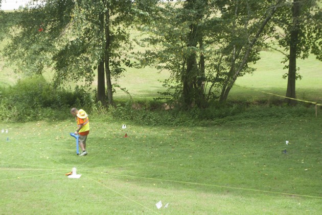
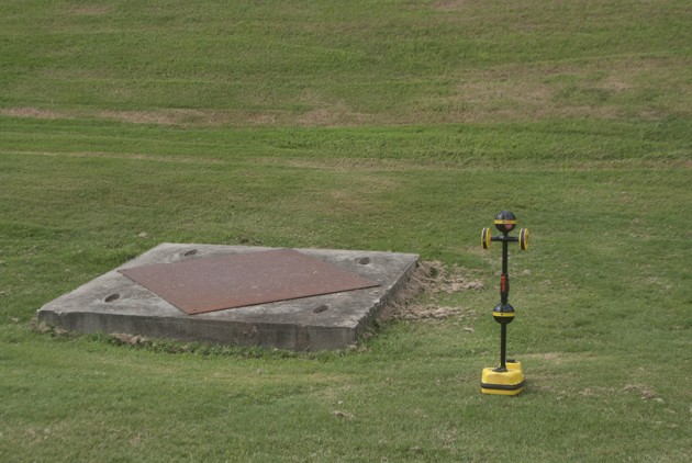
Most of the locating equipment we saw in the field didn’t really look like dowsing rods. They usually involve two pieces of equipment. One piece looks like a cross between a defibrillator and a handheld vacuum. It’s called the transmitter case. This part connects a ground stake to a transformer or cable box, applying a signal to the pipe or cable being located. The other looks kind of like a metal detector combined with a leafblower, except instead of letting out air it emits various electronic yelps and hums that reflect the strength of that signal—and therefore the location of that conduit.
It’s fascinating technology, and as the manufacturers sponsoring the rodeo were quick to tell us, it’s only getting better. (While the SPX Radiodetection RD8000 was probably the most popular model at the rodeo—perhaps because the largest contractor in the business has been buying them like crazy—I have a purely aesthetic affection for the Vivax-Metrotech models. They make way cooler sounds.)
Old-timer locators are at times dismissive of the growing “bells and whistles,” insisting that the best locating equipment are your eyes and brain. Locators are experts in the minutiae of landscape. Variations in strains or color of grass and cracks in pavement can offer as much insight as a device equipped with Bluetooth or elaborate touch-screen interfaces.
The difficulty of the locate depends on several factors—whether the utility being located or the conduit that utility is in are in fact conductive (pipes need to be metal to actually transmit a signal; for this reason, nonmetal pipes are usually buried with something called a tracer wire), whether the locator has chosen the right frequency, the topography of the locate site, even sometimes the composition of the soil or how recently it’s rained.
Ultimately, it all comes down to the skill of the locator, and if he or she gets it wrong, a lot of other things go wrong. Things like gas explosions destroying buildings. Or entire hospitals getting shut down by a sliced fiber-optic cable. Or water main breaks that bring traffic to a standstill.
A locator can do thousands of solid locates a year, for decades, but that one time he or she is a half-inch off when marking a cable will be the only thing that matters. Most people only pay attention to utility locators when something blows up. At least that’s what I heard again and again at the rodeo—from a Georgia 811 employee, salesmen, managers, and locators alike. (A spokesperson for 811 later offered a more measured characterization: “Often utility-locate technicians are noticed when things don’t go as planned.” In practice, things not going as planned tends to mean when something breaks, shuts down, or explodes. )
The rodeo exists because, for the other 364 days out of the year, locators mostly go unseen by the general public—despite, or in a weird way almost due to, their magnificent high-visibility neon yellow safety vests. It’s one of the few chances that locators get to shine and be appreciated among their peers.
Georgia 811 conceived of and held the first rodeo in 2001. This was shortly after the U.S. Department of Transportation published the 1999 Common Ground Study, which sought to establish nationwide best-practices for public and private utilities. The mandate to perform the study was rolled into the 1998 Transportation Equity Act for the 21st Century, a bill named before the 21st century revealed itself to mostly be a time of colossal infrastructure neglect and defunding.
It wasn’t until 2005 that the FCC officially designated 811 the nationwide number for one-call utilities—and it would be another two years until the service was fully implemented. Prior to that, many had already adopted the “one-call center” model, but at least until the late 1960s some states still had separate numbers for notifying each utility.
It’s amazing what a federal standardization and a best-practices initiative can do to turn a trade into an industry. While locating has been around for decades, it seems like a lot of the professional associations and certification training programs really took off after 1999. All of these initiatives are strongly supported by the Common Ground Alliance, a group formed to continue to carry out the work of the original Common Ground Study.
Today, a lot of municipal and state-level locating is contracted out to companies whose workers can locate all kinds of utilities. While there have been private locators as long as there have been utilities to locate, they really took off in the 1980s and took on a larger and larger share of the industry after 2005.
Among the most prominent of these contractors is the marvelously pragmatically namedUnited States Infrastructure Corporation. USIC has technically only been in operation since 2008, after buying out dozens of smaller locator companies. They currently operate in 40 states and claim to "protect the assets of over 90 percent of the Fortune 500 Utility and Telecommunications Companies in North America." They also have amazing videos and, apparently, the best cones.
The shift to private contracting makes sense for agencies seeking greater efficiency—why send four people from four different companies to make markings on the street when you could send one?—and it’s a shift that some municipalities are making internally, retraining workers from the water department to also locate power and vice versa. It also offers a perhaps less-obvious benefit of plausible deniability. When a city worker makes a locating mistake and something bad happens, it’s on the city. When a contractor makes a locating mistake and something bad happens, it's on the company—and, ultimately, it’s on the locator.
There’s no one type of person who becomes a utility locator. The majority of locators at the competition were men, apparently a reflection of the field as a whole. One competitor told me she was one of four women who are USIC locators in her entire state. The majority of competitors were from USIC, but a number of smaller contractors, and government-run utility companies were also represented.
We met locators who’d fallen into the field while doing construction for Southern Bell 30 years ago, locators who grew up among locators, and a sizable number of people who’d only entered the industry in the last five years in search of a career change—from bartending, marketing, printing, and, in one case, being in a metal band in Santa Cruz.
The most commonly shared characteristic was a dedication to the work, and a recognition of its gravity.
“No one really understands how much stuff is in the ground,” I was told, repeatedly. Not even locators really know. I heard generalized numbers thrown around in the millions of miles, but even that’s only for publicly installed utilities like municipal power grids and gas mains. That doesn’t take into account privately installed cables for office-park street lights or privately held dark fiber running low-latency trades from New York to Chicago.
I’d assumed all these miles of cable—or, at least, the publicly managed ones—were long-ago mapped, and remapped regularly. It’s one of the agreed-upon best practices of the 1999 Common Ground Study’s section on utility locating. However, the second-most repeated sentiment I heard from locators was “never trust a map.”
It’s less a problem of inaccuracy so much as one of incompleteness and outdated records. It’s up to the locator to fill in the gaps with spray paint. Those markings rarely, if ever, end up back in maps (although, as I was also told many times, the only thing a locator should trust less than a map is someone else's locate markings).
At some point in the development of underground infrastructure, someone decided that it was easier to repeatedly send people into the field to spray paint the street and put tiny flags in the ground than it was to have accurate, precise records of what exactly was underneath it. This approach is possibly cheaper—a perusal of Glassdoor, the salary-tracking site, suggests the average wage of a utility locate contractor ranges from $12 to $20 an hour—but it isn’t without risk, much of which the locator has to bear professionally and personally.
But no one at the rodeo viewed their work as burdensome, merely what needed to be done and a job worth doing, and the weekend’s events were only peripherally about the dangers of unlabeled and potentially explosive utilities. The rodeo was about putting the locators in the spotlight and, as we were told the night before the competition, it was about having a good time.
* * *
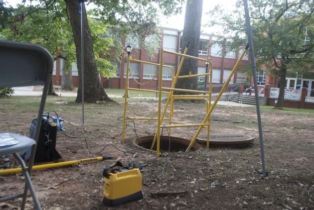
The buses left the Marriott before dawn for a little over an hour’s drive to the UWG campus. Outside the Atlanta Airport Citadel lies the low-slung, set-back architecture of the greater metropolitan area. It was a relief to see chipping paint and fading signs after days in the collapsed context of windowless hotel conference rooms and incoherent carpet patterns. We were in the field, where locating really happens.
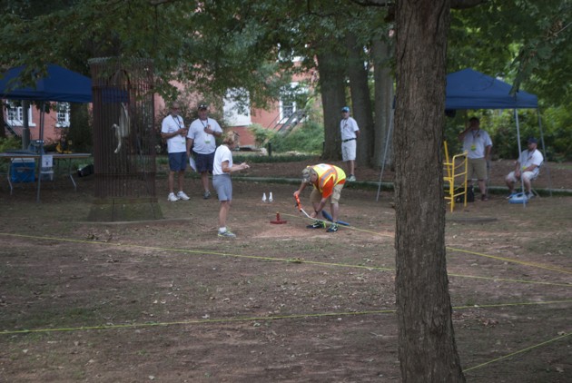
The rules of the rodeo are lengthy and at first glance appear pretty byzantine, which is because they are. The official Locate Rodeo video might explain this more clearly, but here’s a rough overview: There are four divisions (electric power, gas, water, and telecom), with three courses for each division. Each course has a “wheel” drawn in the ground, made with 8 strings attached to stakes forming a series of spokes. The locator has to locate his or her conduit using either flags or commemorative rodeo coins, then measure the distance of that coin from the center of the wheel against each string spoke. There’s a litany of potential infractions and other rules, but ultimately comes down to that measurement. Participants have 12 minutes for each course.
There’s also the “Locate From Hell,” a three-minute competition where locators cannot use their own equipment and have to basically do the exact same thing but faster and locating a specific utility that may not be their specialty (telecom cables, it turns out, are only second to water in nonconductive conduit in their ability to frustrate locators).
We started with the Locate From Hell, which gave us a rapid-fire introduction to the subtleties of locator technique. How far from the ground the locator holds their equipment, how broad a sweep they perform, which frequency they choose to set their transmitter to all shape the locate.
The UWG campus provided a versatile site for a locate rodeo by having a wide range of real-world locate scenarios. Locates took place alongside power substations, up rolling hills, and surrounded by buildings. While watching the competition, I tried to imagine the network below the ground. Locators are among the few people who can even begin to comprehend that dense archaeology—the ghosts of no longer used telecommunication networks, of housing booms and busts that necessitated new conduits, of urban planning that saw underground utilities as a way to create a more bucolic, natural landscape. America tries to protect but inevitably forgets its incomprehensible, aging, and in some places crumbling infrastructure by burying it.
For an activity that’s mostly walking and measuring, watching utility locating is actually pretty spellbinding. The sounds! The colors! The opportunity to compare and contrast performance by other locators! We even had favorite competitors—the no-nonsense locator from Georgia Power who’d been competing every year since the beginning, the member of the Canadian contingent (the only reason the rodeo is deemed “International”) who got motion sickness on the bus to UWG, the rodeo rookie who told me that that flying to Atlanta was her first time taking a plane.
“People watch golf,” Sam whispered as we watched a telecom division competitor. “This is way more interesting than golf.” We imagined color commentary on ESPN3 noting the unique challenges of different locate sites.Now, for the experienced rural locator this one’s a piece of cake, Jim, but it’s going to be baffling to the city locator to not have a handhole or a pedestal to open up.
Although the weather was far milder than it had been in previous years, the late summer Georgia humidity really began to bear down as the day drew to a close. Imagining buried utilities turned into mirage utilities. The locators were shuttled from competition sites back to the parking lot and then back onto buses to the hotel, where they had a few hours before the banquet and award ceremony announcing the rodeo champions.
* * *
On our way back, we took a brief detour for an extra round of infrastructure sightseeing. While Google doesn’t publish the addresses of their data centers, they can be found, and there was one on the way back to the Marriott. The sign at the entrance was half-buried beneath pink flowers, as though the Google logo were peeking out from behind them whispering, “Can they see me?” Like most past attempts at data center pilgrimages, we were quickly rebuffed at the entrance, only able to catch a glimpse of the 500,000-square-foot compound. When infrastructure isn’t hidden beneath the ground, it’s frequently sequestered behind gates and security imperatives.
For a long time I’d been chasing the Cloud believing I just needed better maps and better data—on the data centers, the fiber routes. After spending time with the people who follow, revise, and fundamentally distrust the maps, I’m less and less sure that having one is even the point. Even if by some act of divine providence all the telecoms opened all their data on all their dark fiber and data centers, I’d want—and frankly, the world would still need—utility locators and cable markings. Seeing systems at a distance may allow patterns to emerge, but it also affords them a coherence, infallibility, and control that they might never really have.
Ever since I started looking for visible signs of infrastructure, I’ve heard people tell me that it’s invisible. “Invisible” is a word that people use to describe things—cables, networks, systems, people—when they don’t want to admit they are still learning how to see. It is a word that suggests subterfuge where there might be only incompetence, a master plan where there may only be a missing or outdated map. Locators see this system for what it is: fragmented, full of lost and abandoned histories, and, while very hard to see, impossible to ignore and forgotten at great cost.
(Image via asharkyu/ Shutterstock.com)