Drones for Good
StartThe unmanned aerial vehicles carrying out international strikes are perhaps the best known examples of government-operated drones.
But there are many other ways the federal government uses unmanned systems—and they aren’t just aerial drones. Government-owned unmanned systems skim the surface of water and observe the depths of the ocean on survey missions; they’re also sent to monitor the border, on land and in the water.
As the Federal Aviation Administration mulls appropriate regulations for drones—the first Drone Advisory Committee meeting was in September—the unmanned systems could soon become much more commonplace.
Here’s a look at a few ongoing government drone projects, as well as recent investigations into future applications.
1/10
Monitoring Sea Life
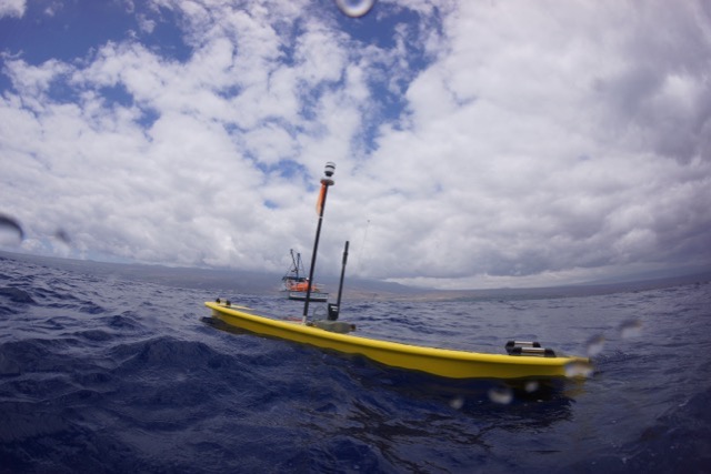
Credit: Liquid Robotics NOAA uses an unmanned surface robot to gather data about the sea life.
The agency has a contract with Liquid Robotics, a division of Boeing, for a surface-skimming machine called the Wave Glider. In one NOAA project, that drone collected information about the proliferation of phytoplankton, whose presence can be linked to deep-sea carbon levels, according to NOAA. The Wave Glider generates its own energy supply from ocean waves; because it doesn’t require fuel, it can travel for up to a year on its own. Other Liquid Robotics customers use the Wave Glider for anti-submarine warfare, according to the company.
2/10
Responding to Oil Spills
Credit: NOAA NOAA has also tested aerial aircraft for oil spill response.
The U.S. Fish and Wildlife Service collaborated with NOAA and the Air Force to see how drones could be used to assess the damage from natural disasters.
The agencies deployed AeroVironment’s PUMA drone near a simulated oil spill to collect images that could estimate the area and volume of the spill. According to NOAA, the drone did just that, and also provided photo and video images of nearby sea life, including dolphins and sea lions, so the teams could assess potential damage to those animals.
3/10
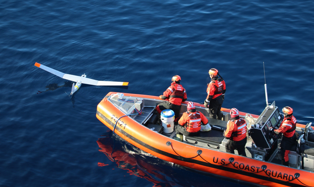
Scouting the Antarctic
Credit: AeroVironment The Coast Guard sends unmanned scouts to assess harsh weather conditions in the Antarctic.
The Coast Guard has also used NOAA’s PUMA drone on its icebreaker, Polar Star. As part of Operation Deep Freeze, an effort to supply the National Science Foundation’s Antarctic station, PUMA is deployed to scout treacherous parts of the sea in advance of its icebreaker.
4/10
Tracking Spaceships
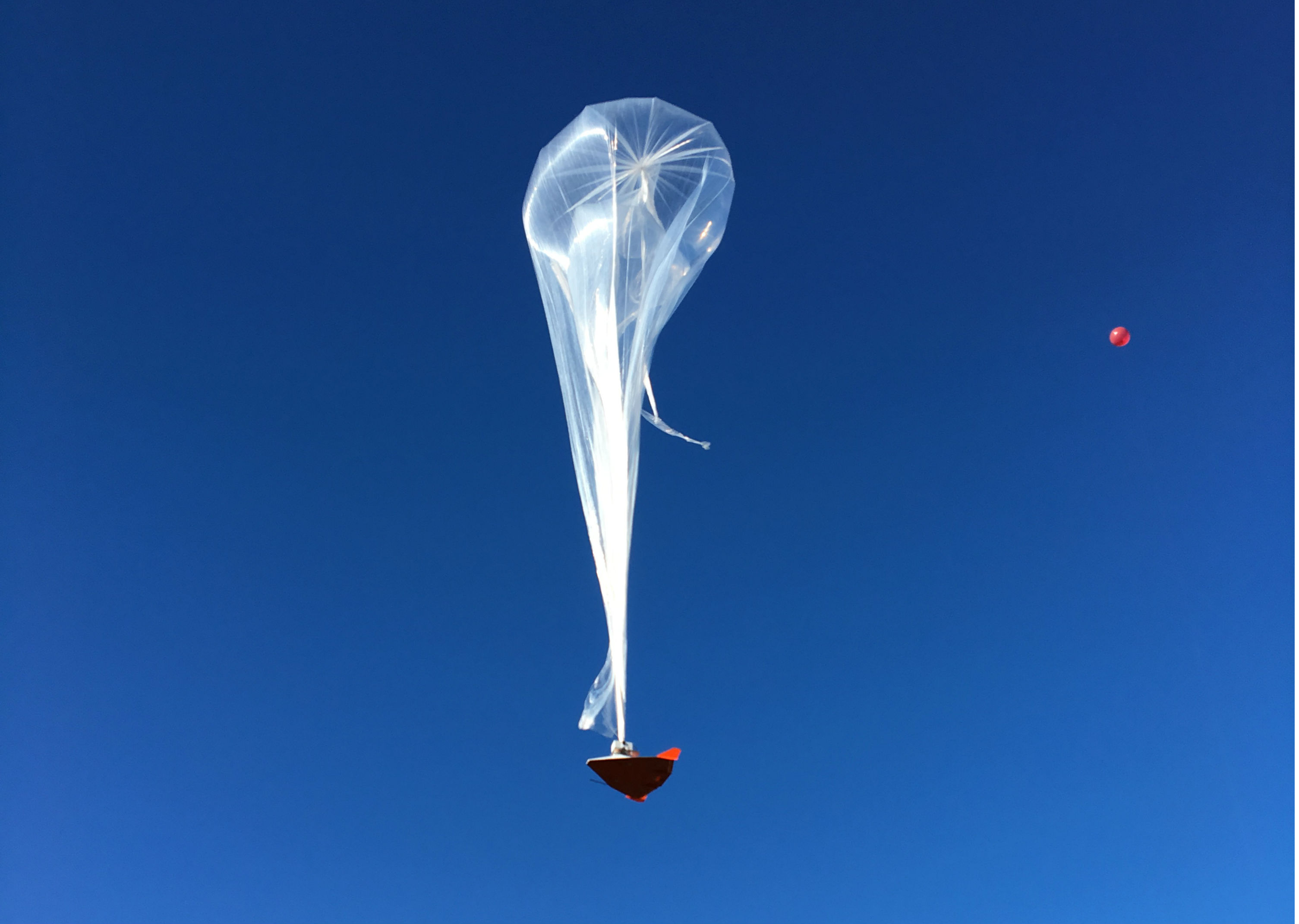
Credit: Near Space Corporation NASA is funding part of an FAA surveillance program that aims to track commercial spacecraft as it re-enters national air space.
Near Space Corporation conducted a test flight earlier this year for this program; it launched a balloon-borne drone that simulated how an aircraft might travel in American airspace, and FAA tested its air traffic control systems.
5/10
Protecting Borders
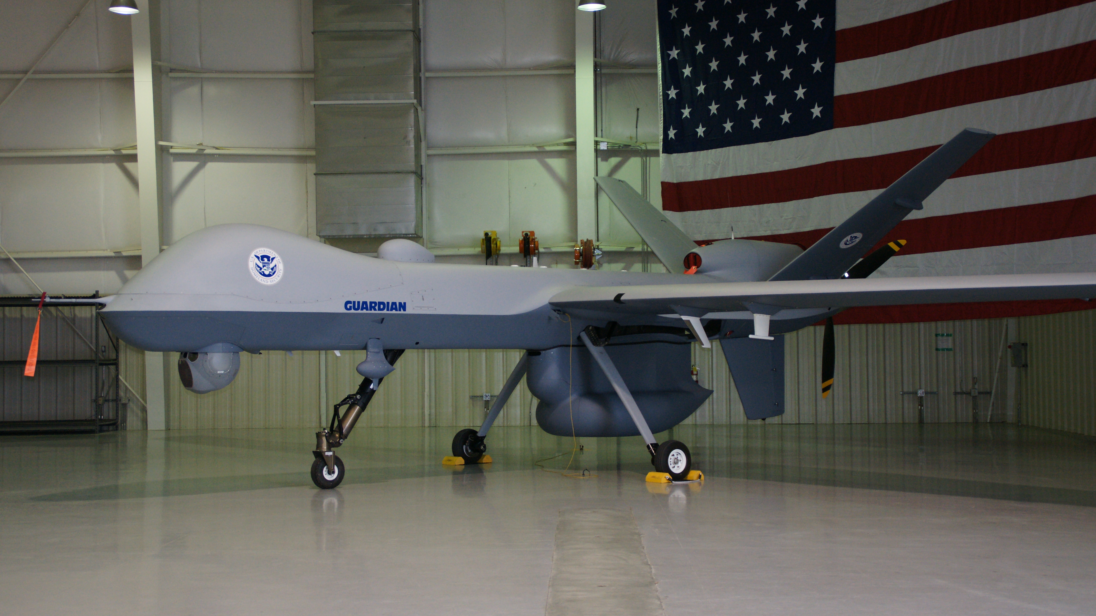
Credit: DHS The Homeland Security Department used unarmed Predator drones—a variant of the kind used by the military for drones strikes—for border patrol.
Customs and Border Protection’s Air and Marine Operations used Predator B drones, created by General Atomics, to “identify and intercept potential terrorists and illegal cross-border activity,” according to DHS. Those devices have been deployed along the Texas border since 2011, on the Northern border since 2009, and the Southwest border since 2005.
The aerial drones can reach an altitude of about 50,000 feet, and are equipped with infrared sensors and radar to help surveil moving targets, according to DHS. CBP also recently awarded a roughly $25,000 contract to Digital Plaza, which sells drones equipped with video and photography capabilities.
6/10
Securing Harbors
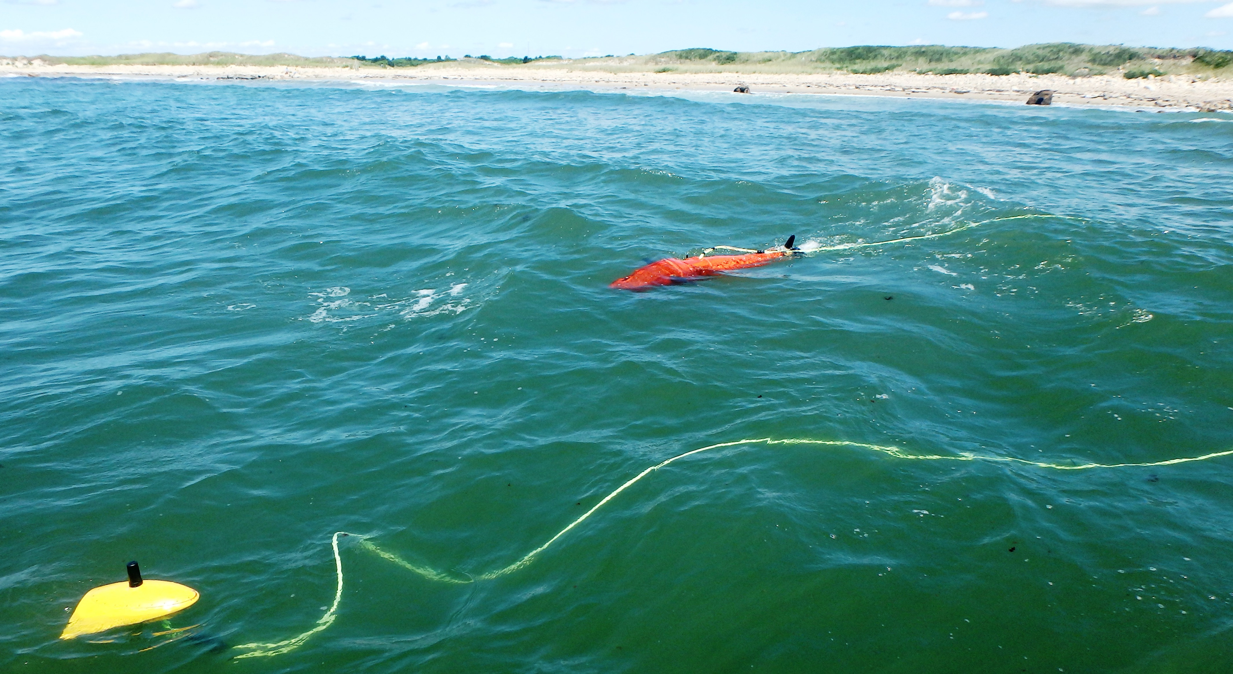
Credit: Boston Engineering DHS’ Science and Technology Directorate is funding a program that uses semi-autonomous underwater drones to inspect ships for illegal contraband and to surveil harbors.
The Bioswimmer, developed by Boston Engineering, uses sensors to detect when objects attempt to cross borders under water. That drone is designed to mimic the bluefin tuna—especially the way it twists and turns in small spaces, according to DHS.
7/10
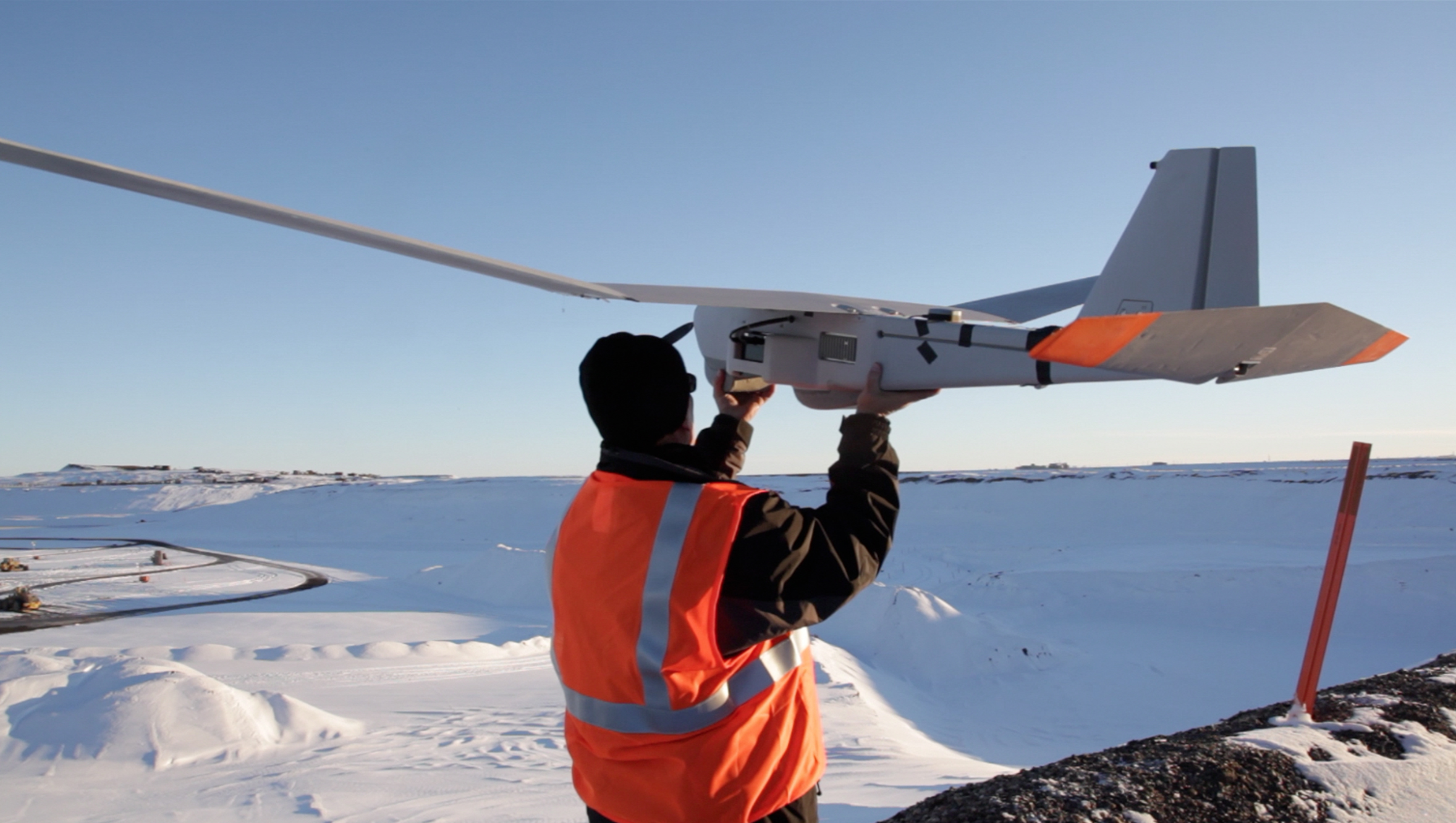
Monitoring Crops
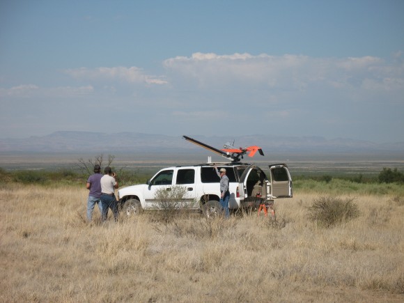
Credit: USDA The Agriculture Department’s Jornada Experimental Range is evaluating how useful unmanned aircraft may be in collecting data from vast expanses of land. USDA has two aircraft, each with a 6-foot wingspan, that can capture color images, generally from about 700 feet above ground. USDA uses image-analysis software to classify the images those drones collect, which then might be used to estimate the spread of shrubs or grass, for instance.
8/10
Pushing the Limits of Refueling
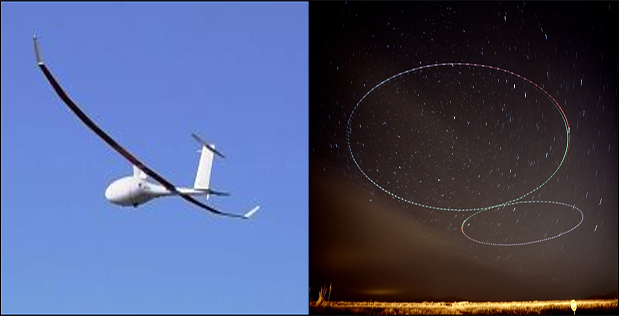
Credit: DARPA The Defense Advanced Research Projects Agency is funding aerial drones that could travel for 10 days without refueling.
DARPA is backing a small business producing drones that can fly for at least two days and two nights. At 15,000 feet, Vanilla Aircraft’s drones can carry a 30-pound payload; according to DARPA, its test last year set a record for the longest flight for a diesel-powered drone in its weight class.
The test flight was cut short because of bad weather, but the drone is designed to be able to travel for more than a week in one trip. The Defense Department could use the drones for surveillance and reconnaissance, according to DARPA.
- Start Over