Feds divulge sensitive mapping data to head off Colorado wildfires
U.S. Forest Service


Officials grant state authorities access to information about critical infrastructure.
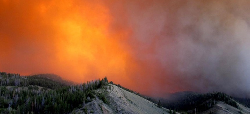
The federal government has granted Colorado authorities fighting deadly wildfires access to sensitive data that pinpoints high-value, critical infrastructure, such as bridges containing utility lines, according to a contractor mapping the data. The information release is intended to help the state predict which assets may be in danger and in need of immediate protection.
The Homeland Security Infrastructure Program is a compilation of about 500 layers of geographic features, including power plants and water pumps, managed by the Homeland Security Department, the Pentagon’s National Geospatial Intelligence Agency and the U.S. Geological Survey.
The full HSIP data set amassing statistics from government, industry and academia are available only to state responders when federal disasters are declared, such as the fires ravaging the hillsides west of Colorado Springs. The Waldo Canyon fire there has burned through more than 18,500 acres of land, threatening more than 20,000 structures, including many homes of military families, Pentagon officials said.
By combining HSIP, live weather conditions and other updated information, state responders “are predicting where the fire is likely to go [and] where they need to allocate resources to protect the highest natural resource values and developed values,” said Russ Johnson, global director for public safety at Esri, the software firm helping decision-makers analyze the data sets. “The state is using HSIP data to fuse it with the [fire] perimeter data to understand what the impact and the potential impact on infrastructure could be.”
Esri has posted a dynamic map based on public information similar to the graphics that authorities are using to gauge the effects of the fires.
The in-depth HSIP geospatial information also helps response teams know where to go and what areas to avoid when thrown into unfamiliar -- and now unmarked -- areas.
With mobile ubiquity, “we have intelligence coming back in, right from the field,” Johnson said. “The HSIP data is very valuable when combined with this real-time information.”
The convenience, which translates into faster aid, did not exist when Johnson was a U.S. Forest Service operations chief responding to 1988’s record-breaking Yellowstone National Park fire. Incident management personnel at the time would scout the area from the air and the ground every morning and then travel back to a central coordination center. With HSIP and automated data feeds, “it’s not somebody having to go out and fly the fire.”