Facebook for Trees: The Forest Service’s Quest to Make a Tree Database More User-Friendly

Mark Carthy/Shutterstock.com


 By
Frank Konkel
By
Frank Konkel
The agency maintains a database that includes various characteristics of some 19 million trees over some 350,000-plus plots of land
The U.S. Forest Inventory and Analysis program is essentially the U.S. Census Bureau for trees. The agency maintains a database that includes various characteristics of some 19 million trees over some 350,000-plus plots of land across America and as far away as Guam and the Caribbean Territories.
FIA’s data dates back some 80 years and includes forest carbon records, tree migration patterns and other historic trends. But until recently, it’d have been hard for all but the most ardent dendro-enthusiasts to get excited about it.
That’s because FIA’s high-quality, authoritative data sets were published to be consumed by Congress, state agencies, industry and other stakeholders in paper-based reports, also known as the least engaging and most boring format imaginable.
“We realized we were missing an opportunity to tell our stories in novel ways,” Dr. Charles Perry, a research soil scientist at the Forest Service, told Nextgov. “We realized we were sitting on a gold mine – a database with millions of trees, trends over time that is telling us things about harvesting and climate change and urban development – but we’re not capturing and delivering its full potential.”
Enter maps.
Or more specifically, a slew of new mapping tools and applications through relationships with companies like Esri.
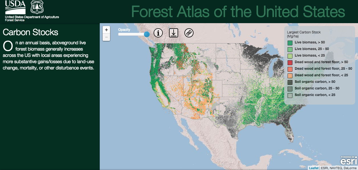
The Forest Atlas of the United States, one visual expression of data made possible through Esri’s software-as-a-service offering, ArcGIS, allows users to navigate complex data sets using their Web browser.
While its final version is still in the works, the Forest Atlas already offers customers a simplified visual experience. For comparison's sake, this is what a user is presented with when searching for information on carbon stocks of U.S. forests today through the Forest Atlas.
And here is what searching for similar information looks like through tools on FIA’s old website.
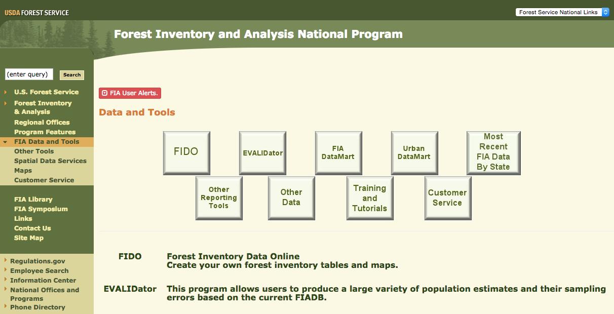
In both cases, users can download data dumps in various formats useful to developers. But John Steffenson, Esri’s Forest Service specialist, said mapping tools allow for information products that are more engaging, and that is likely to bring in new customers.
Incorporating mapping tools to link tabular data and charts with the real world may not make a significant impact on FIA’s prime users, like the logging industry and conservation outlets. But opening up the data through visually appealing information products may attract more interest from scientists, media, decision-makers or the biggest untapped customer base known to the Forest Service: citizens.
“FIA had the epiphany to broaden its sphere of engagement, not just to industry and forest people, but to the general public,” Steffenson said. “It’s really exciting to see this amazing wealth of information released out there in a way people can understand. It’s really starting to bear fruit.”
NEXT STORY: EPA’s Digital Chief Steps Down