US Geological Survey inks partnership to look beneath Earth’s surface using quantum sensing

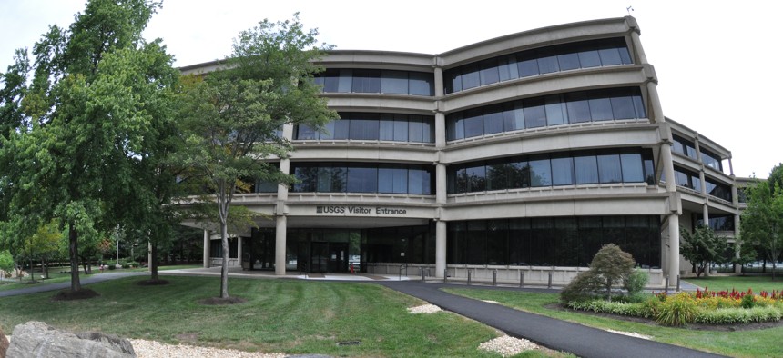
USGS headquarters in Reston, Virginia. The agency is looking to quantum sensing technologies to look below the surface of the Earth. Don Becker/U.S. Geological Survey
The U.S. Geological Survey entered into a new collaborative partnership with quantum technology company Q-CTRL to explore if quantum sensing can help find critical minerals and predict natural disasters.
The United State Geological Survey is deploying new advanced sensing technologies to better monitor and explore Earth with dual goals of identifying deposits of natural resources and preventing potential disasters.
In a new partnership with quantum sciences and technology company Q-CTRL, the USGS plans to improve how well researchers can see into Earth’s subsurface. Jonathan Stock, the director of the USGS National Innovation Center, said that the pilot program aims to leverage quantum sensing systems to help accurately identify reserves of critical minerals and water, particularly as the U.S. economy attempts to pivot toward new energy sources.
Some of the technologies Q-CTRL and USGS’s partnership will debut include quantum gravimetry and quantum magnetometry — the sciences that measure the strength of a gravitational field and magnetic field, respectively.
By leveraging Q-CTRL’s quantum physics-based systems for their gravimetry and magnetometry tools, USGS scientists will ideally be able to glean more accurate data about what lies beneath the Earth’s surface without extraneous noise that can interfere with data.
“We are hoping [quantum sensing technologies] will turn the very fuzzy picture of the subsurface resources and hazards into a much sharper picture of the subsurface hazards and resources at a much lower cost, and therefore we can do it more often and over more areas,” Stock told Nextgov/FCW.
In addition to looking for extra deposits of critical minerals and water, Stock said that USGS is also looking to use advanced sensing technologies to identify potential natural disasters before they happen, such as predicting the likelihood of a volcano’s eruption.
“The partnership… with Q-CTRL is all about new tools to shine a light in the subsurface, to find resources and hazards,” he said.
The collaboration between Q-CTRL and USGS is part of the U.S. Department of the Interior’s Cooperative Research and Development Agreement program. Both entities will jointly host workshops and field investigations to explore if these quantum sensing additions can aid in USGS’s operations.
Q-CTRL CEO and Founder Michael Biercuk told Nextgov/FCW that Q-CTRL’s collaboration with USGS works to use trapped atoms to probe gravity, thereby gaining insights into what is below Earth’s surface. This is just one of the field applications Q-CTRL’s quantum-based software looks to improve.
“We've built some of the world's best quantum gravity emitters, augmented with software so they perform well if you put them on an aircraft or if you put them on a maritime vessel,” Biercuk said. “We have new capabilities to monitor how water levels are changing underground, which of course is very, very important for climate monitoring, but also for general resources monitoring.”
Stock added that the partnership will help vet emerging technologies’ roles in government missions and identify what can serve as an asset for future initiatives.
“Right now, it's risky, it's new, it hasn't been shown necessarily at the scale it would need to be shown to have a strong return on investment,” he said. “But what if with this kind of partnership, our scientists and their technicians and engineers show that this could be an amazing asset for finding things we couldn't find before?”


