Pentagon’s roving intel center helps emergency responders
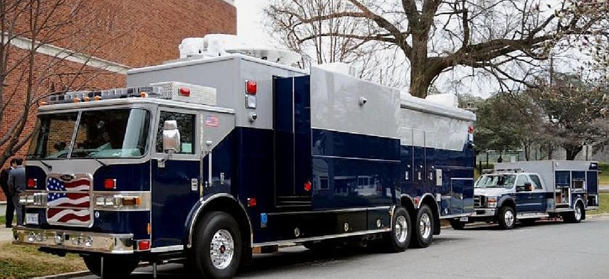
The Domestic Mobile Integrated Geospatial-Intelligence System can discern the location of critical infrastructure.

The Domestic Mobile Integrated Geospatial-Intelligence System can discern the location of critical infrastructure. National Geospatial-Intelligence Agency

When civilian officials call, Defense dispatches mobile geospatial data center packed with communications gear, mapping equipment and analysts.

The moving carries generators and a 2.4-meter satellite dish antenna. Inside, printers can deliver directions either on a computer screen or a piece of paper. On Monday during Hurricane Sandy, wherever iPads, iPhones and Android-devices had connectivity, federal officials also were clicking on HSIP-enabled apps, said Russ Johnson, global director of public safety and disaster response for GIS contractor Esri. The company’s onsite specialists are helping Federal Emergency Management Agency officials mash up data feeds detailing  live conditions with HSIP information. They “pull together that which they understand would be most damaging if impacted, then they display  the model of the hurricane, population effects data, shelter locations, road outages, power outages” and other updates, he said. The federal officials are focused on current factors affecting critical infrastructure that is necessary for continuity of government operations, such as subway systems and federal buildings, Johnson explained. He said the DMIGS systems are positioned but did not know their exact locations. A big concern logistically is trees on the ground. Federal officials “are working on some applications to identify dynamically in the field where trees are down so they can map that and send it down to the operation centers,” Johnson said. The resulting graphics would detail the size of fallen trees, whether trunks require heavy lifting, proximity to power lines and other issues of concern, he said. On Monday, NGA and DHS spokespeople could not comment on the mapping assets because emergency officials were not available to respond. The emergency officials were out in the field, the headquarters spokespeople said.

When street signs fall and cell towers fail, the Pentagon is ready to dispatch a high-tech command center with digital mapmaking gear for federal emergency responders arriving in unfamiliar hurricane-ravaged regions.

In response to a civilian agency’s request, the Defense Department’s Domestic Mobile Integrated Geospatial-Intelligence System, or DMIGS, can discern the location of critical infrastructure. The 44-foot long vehicle is built like a fire truck and contains technology similar to the computers and communications available at the National Geospatial-Intelligence Agency headquarters.

data center

At the scene of a disaster, up to six analysts aboard the DMIGS consult the Homeland Security Infrastructure Program, or HSIP—a repository of about 500 layers of mapped-out features, including power plants, rivers and roads.


Throughout past storms, when wireless devices were working, federal officials used similar HSIP-base apps. “During Hurricane Irene, when search-and-rescue teams were deploying, they were able to have all the map data that normally they would need huge paper atlases to see,” Dan Cotter, then Homeland Security Department chief technology officer told Government Executive Media Group in June. The DMIGS also was deployed during the August 2011 storm.