Uber Takes to the Skies
Syafiq Adnan/Shutterstock.com


The satellite-imagery giant DigitalGlobe will now provide high-resolution Earth imagery to Uber.
As any 911 dispatcher or Pokémon Go player can tell you, the modern megalopolis consists of at least two layers.
First, there’s the physical stuff that makes up the city. This is the asphalt, the fire hydrants, the refrigerators, the pick-up trucks, the trees arranged in neat rows. When you see these things in a photo—whether of San Antonio or San Francisco—you know humans live nearby.
Second, there are the virtual rules that define the city and guide its flows. These are the laws, the traffic patterns, the delivery routes, the Yelp check-ins and the Pokéstops, the “soft infrastructure.”
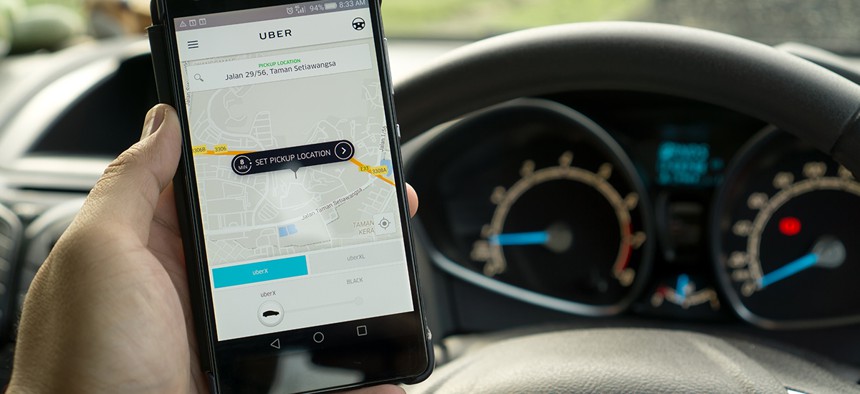
Since it launched, the core proposition of the ride-sharing company Uber has been that it will use the virtual layer to guide people and things around the physical layer. You call for a ride or for food on your phone; a person and a car appear on the curb in front of you.
This year, it has started running that pattern in reverse. Uber is now plumbing the physical stuff of the city to improve its understanding of the virtual layer.
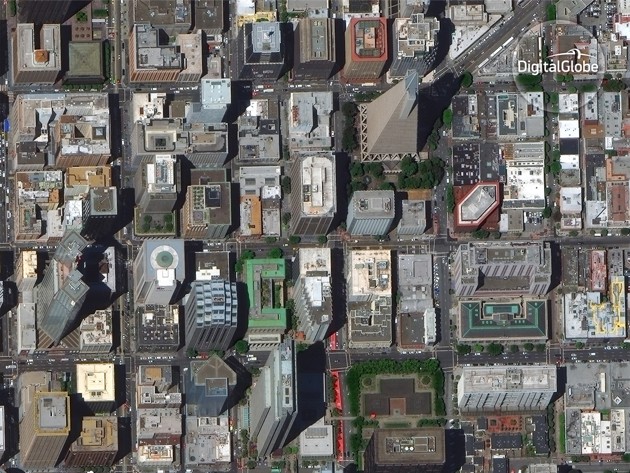
On Tuesday, DigitalGlobe, a satellite-imagery company, announced it will provide high-resolution pictures of the planet’s surface to Uber. DigitalGlobe is the primary provider of satellite imagery to Google, Apple and the U.S. government. When you see a satellite image of your home on Google Maps that shows individual cars and trees, odds are it was captured by one of DigitalGlobe’s four satellites.
Though some of this imagery may eventually appear in the app, DigitalGlobe representatives said Uber seems much more interested in pulling information out of the pictures.
“Urban landscapes are changing all the time,” says Kevin Bullock, the director of product management for the satellite company. “New lanes are being put in, there’s construction everywhere, a two-lane highway becomes a one-lane road with a bus lane.”
DigitalGlobe’s satellites often decipher new road-surface markings, lane information and street-scale changes to traffic patterns before a city adds them to its official vector map, he told me. The highest-resolution of DigitalGlobe’s satellites can detect pixels as small as 30 centimeters across, which lets them resolve most street markings. Some cities, like San Francisco, paint bus and bike lanes a certain color, which also makes them more detectable from the sky.
This level of detail will become increasingly important for Uber. The company hopes to one day replace its human drivers with self-driving cars, in part because robots don’t require pesky niceties like compensation or collective-bargaining rights.
Self-driving cars require maps persnickety in their detail. Many self-driving cars navigate city streets less by taking in footage of the world and negotiating it as-is, and more by accessing a highly accurate facsimile of the world and effectively driving through that simulation.
Unlike its rival Google, which has invested in maps for more than a decade and already boasts the world’s most-used digital map, Uber has no built-in advantage in the area. So for the past year, it has worked to buy its way in. Since March 2015, Uber has acquired the mapping team from Microsoft Bing; it has partnered with the navigation company TomTom and hired away old Google Maps execs.
The new Uber-DigitalGlobe deal also points to the increasing value and decreasing novelty of satellite imagery in general. Uber is not the only company that will spend the next decade intricately piecing together a detailed virtual representation of the world—a database, in other words, that can fully represent the city’s physical stuff to its virtual layer.
Numerous small-satellite startups have popped up in the last few years. These companies promise they will photograph spots on Earth many times per day, perhaps once an hour; and they hope farmers, insurance providers, development organizations and U.S. companies working overseas might come on as potential clients. The photographic fruit of those startups, however, will be much lower-resolution than what DigitalGlobe can muster.
And DigitalGlobe, for its part, is trying to find a balance between high spatial resolution and frequent revisit rates. It says it will be able to capture more imagery more often when it launches the new, high-resolution satellite WorldView-4 in September. Perhaps, you’ll be aided by imagery from that satellite—if only programmatically—as you hop in an Uber ride this winter.
NEXT STORY: America’s Network of Secret Bomb Detectors