Google's Satellite Map Gets 700-Trillion-Pixel Makeover
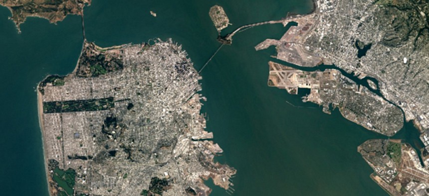
Google Maps's newest depiction of the San Francisco Bay area includes certain features, like the new span of the Bay Bridge, that just weren't there in 2013. Google/Landsat


It’s the cloudless map’s first major makeover since 2013.
More than 1 billion people use Google Maps every month, making it possibly the most popular atlas ever created. On Monday, it gets a makeover, and its many users will see something different when they examine the planet’s forests, fields, seas and cities.
Google has added 700 trillion pixels of new data to its service. The new map, which activates this week for all users of Google Maps and Google Earth, consists of orbital imagery that is newer, more detailed, and of higher contrast than the previous version.
Most importantly, this new map contains fewer clouds than before—only the second time Google has unveiled a “cloudless” map. Google had not updated its low- and medium-resolution satellite map in three years.
The improvements can be seen in the new map’s depiction of Christmas Island. Almost 1,000 miles from Australia, the island was largely untouched by human settlement until the past two centuries. Its remoteness gives it a unique ecology, but—given its location in the middle of the tropical Indian Ocean—it is frequently obscured by clouds. The new map clears these away:

A 99-acre immigration detention center operated on behalf of the Australian government can now be clearly seen; it’s the only tan splotch of development in the island’s northwestern “arm.” In the old version of the map, the detention center was harder to distinguish from clouds. The island’s eastern settlements are also now completely visible. Compare the old version of the map:
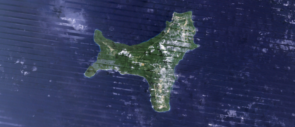
The new map also does not include the darker diagonal lines that seem to slice across the older scene above. These lines were caused by a physical malfunction on Landsat 7, the U.S. government satellite which supplied the older map’s imagery data. The new version of the map includes data from Landsat 8, the newer version of the same satellite, letting Google clear the ugly artifacts.