To Map Crisis Zones, Humanitarian Groups Turn to the Crowd
Mapswipe


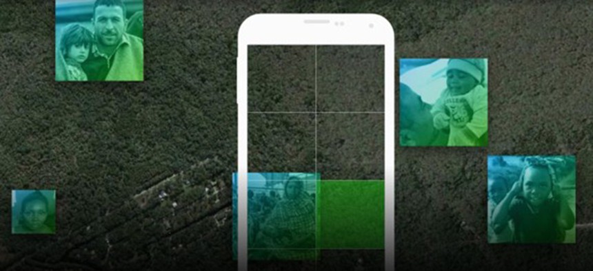
With a smartphone app and some idle time, you can help groups like the Red Cross navigate areas in need.
When diseases break out in remote villages, emerging cities and informal settlements, the first challenge for aid workers often comes from insufficient maps. Without quality, up-to-date information, humanitarian workers have trouble knowing how to enter a crisis zone, and what to do once they’re there. It’s a challenge that led to the creation of the Missing Maps project in 2014, and one that now has the group asking everyone with a smartphone to pitch in.
Since the MapSwipe app launched this summer for Android and iOS, users have been flicking through satellite images of unmapped, crisis-prone regions of the world in order to identify settlements, structures, roads and other features that could be useful for aid workers.
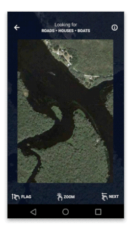
The app serves up images divided into squares and asks users to find signs of human settlements or indicate when the images are unreadable because of cloud cover, poor quality, or blank space. The information gathered this way speeds up work for mappers, and ultimately for medical professionals on the ground in vulnerable and undermapped areas.
The goal, says lead product designer Sadok Cervantes, was “to make the mapping as easy and intuitive as possible so people didn't think of the app as a chore, but rather as a fun activity, something they could do anytime, anywhere.”
The Missing Maps project is a collaboration between the American Red Cross, the British Red Cross, Humanitarian OSM Team and Doctors Without Borders. It uses open source technology to create maps of vulnerable areas for humanitarian organizations serving those areas. Volunteers decipher assigned patches of satellite imagery, marking houses, buildings and streets in OpenStreet map. Locals later perfect the maps.
While MapSwipe began as a way to streamline work for Missing Maps volunteers, its popularity has encouraged its creators to consider opportunities for expansion. Pim de Witte, the lead developer of MapSwipe, says in the future, the app may allow users to place geographic features directly into OpenStreetMaps instead of simply indicating which tiles contain them. The work could also someday help train artificial intelligence systems to recognize landmarks, he says.
The app’s primary purpose is to make detailed and useful maps for humanitarian organizations, but it provides a service to the users, too. Beyond entertainment, it offers a window into the world, and encourages exploration and engagement with foreign and unknown landscapes. It teaches users to look.
To untrained eyes, round huts can blend into an aerial view of rocks and trees. Dry riverbeds might resemble dirt roads. A tutorial on the MapSwipe blog offers tips for distinguishing key features in the satellite images: look for groups of perfect circles to indicate villages or hamlets; notice that rivers meander, while roads tend to run straight. Patterns of settlement and urban growth emerge from the aggregation of tiles, and a more complete picture of the world emerges from the work of anonymous swipers, tappers and mappers.