Join a Drone Over the Indonesian Fires Smoking Out an Entire Region
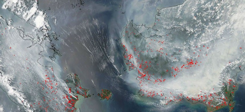
That's Borneo on the right, under all that smoke. Sumatra is on the left. NASA


A strong El Niño climate phenomenon has created particularly dry conditions and led to fast-spreading fires, all captured by drones and satellites.
This summer a large swath of Southeast Asia has been covered by a persistent haze that’s led to health problems, fatal accidents, cancelled flights and events, costly counter-measures, and some surreal political bickering.
The haze occurs every dry season, when fires are set to make land suitable for pulp-and-paper or palm oil plantations on Sumatra and Borneo in Indonesia. But this year a strong El Niño climate phenomenon has created particularly dry conditions and led to fast-spreading fires, notes Guido van der Werf, a researcher at VU University Amsterdam. So far the fires have produced the equivalent, roughly, of Germany’s annual carbon-dioxide emissions, he tells Quartz.
A Greenpeace video posted on Oct. 6 shows footage taken by a camera-equipped drone as it flies over fires burning peatlands, rainforests, and palm oil plantations surrounding Indonesia’s Gunung Palung National Park on Borneo. The footage was shot Sept. 19-21. The image atop this article, from NASA’s Aqua satellite, was taken on Sept. 22.