Here's Where You're Most Likely to Die From Air Pollution
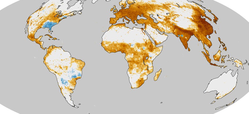
A map representing regions with significant numbers of pollutant-influenced deaths. NASA


A new NASA map of the planet lays out the depressing geographies of smog and premature death.
Where on earth are you most likely to die early from air pollution? NASA provides the answer with this mortally serious view of the planet, and it is: lots of places.
Like tar stains on a healthy lung, the sickly yellow and brown areas in this visualization represent regions with significant numbers of pollutant-influenced deaths. Heavily urbanized places in eastern China, India, Indonesia, and Europe are stippled by the darkest colors of snuff, meaning they experience rates of ruination as high as 1,000 deaths per square kilometer each year.
In good news, areas painted in blue show where humanity has managed to lower its output of choking smog since the 1850s. These safer havens include spots in the middle of South America and the southeastern United States, where the amount of agricultural burning has decreased since the mid-19th century.
This representation of our befouled atmosphere is based on the work of Jason West, an earth scientist at the University of North Carolina who's investigating the health effects of bad air. According to computer models that West and his team constructed, an incredible 2.1 million deaths a year can be attributed to one type of pollution alone – fine particulate matter, or PM2.5, which are teensy specks that fly out of car-exhaust pipes, industrial smokestacks and other things. (They're also what the NASA map is referencing.)